Grysbok Hiking Trail at Koeberg Nature Reserve
The Grysbok Hiking Trail is one not to be missed.
The Speedy Review (tl;dr)
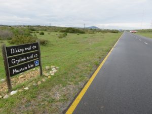
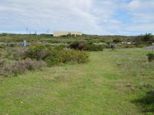
The Koeberg Nature Reserve is situated on the same property as the Koeberg Nuclear Power Station, along the R27 near to Duynefontein. The Reserve is beautiful even though it is within close proximity to a fully functioning nuclear power station. The Grysbok Hiking Trail takes your through a large section of the Reserve, to the south of the nuclear installation. The other hiking trail, the Dikkop Trail, appears to take one through the northern part of the Reserve. It is quiet and the road noise from the nearby R27 is minimal, if at all. The Grysbok Hiking Trail is a great trail for this part of the world, considering that there aren’t all that many hiking routes in the Western suburbs. It is an easy walk through fynbos, gravel paths and sections with beach sand. It is perfect for an outing with the family, including the kids. It is also safe as it is within the perimeter fencing of the Reserve that is guarded by security officials and CCTV cameras.
There are large stretches where the path is very sandy (it is right next to the sea, after all), so be prepared for uneven terrain and the occasional mole hill, through which one can easily fall and injure themselves.
During the Summer months, I would suggest you get there early as the route can get very warm and there is no shade along the trail.
The reserve opens at 08h00 and closes at 16h00; entrance is free.
The only criticism I have of the Grysbok Hiking Trail is the lack of proper signage at certain points along the trail. I brought this to the attention of the Visitor Center staff and I was informed that they had lost a lot of their trail signage during the recent fire they had on the Reserve during February 2016. They are in the progress of re-erecting the trail signage and hope to finalise it by the beginning of 2018. Just keep that in mind if you plan to hike this trail before the beginning of 2018.

Trail Ninometer
![]()
Nina rated this trail 0/5 paw prints, because there are no dogs allowed in the Blaauwberg Nature Reserve and she felt quite left out.
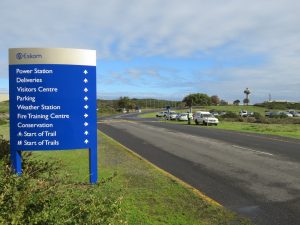
How to get there (plus security do’s and don’t’s)
To enter through the main entrance gate you will be required to produce some form of picture ID (driver’s license/green ID book/) card as this is a legislated National Key Point. No photographs may be taken of the nuclear facility or any of the related installations. Photographs can be taken along the hiking routes though as long as they do not include any of the installations in the photo.
You will need to sign in and thereafter you will be given a visitors sticker which you need to keep with you at all times as this trail will take you passed the other entrance gate and the security officials there may want to check that you have signed in. Yes, this happened to me. Fortunately my sticker hadn’t blown off my top, but had wedged itself under the shoulder strap of my backpack.
Directions to the Start of the Grysbok Hiking Trail
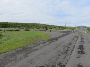
Once you enter through the main gate, drive down a straight road over a few speed bumps. The speed limit on the Reserve is 50 km/h. Keep a watchful eye out for game that may wander across the road. You will come to a 4 way stop.
Although the information board, situated just before the 4 way stop, tells you to carry on straight to the start of the trails, instead, turn right at the 4 way stop and park on the grass on the left hand side.
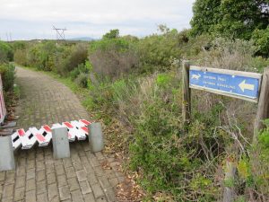
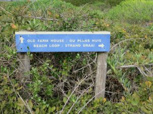
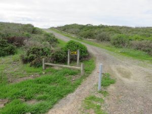
A sign will be visible from your parked car and points across the grass toward a smaller yellow and green sign that depicts a small Grysbok. That sign directs you across the road to the Visitors Center up on the hill.
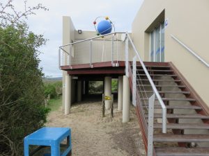
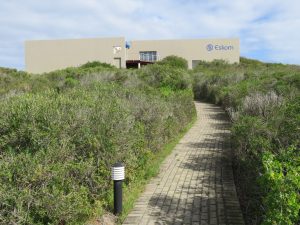
As you approach the Visitors Center, walk past the sign that shows that the Grysbok Trail starts off to the left along a paved path. That is the disabled entrance to the Visitors Center. Keep going to the right and take the stairs to the Visitors Center.
Another, easier option is to park at the Visitor’s Centre and walk up the stairway to the start of the trail.

On the day I hiked this trail, the disabled entrance was closed due to some recent flooding. It is important to report to the Visitors Center before you start the trail to collect an information brochure with a map as well as a pamphlet containing the bird species that live on or frequent the Reserve. Both are free of charge.
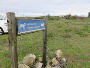
The Grysbok Trail starts at the yellow and green signpost below the wooden deck of the Visitors Center. The path goes between the pillars of the Visitors Center and the small wooden fence on the left. It winds around the back of the Visitors Center and becomes a wide beach sand track.
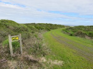
The Grysbok trail follows a numbering system that seeks to highlight interesting places along the trail. These locations are listed on the information brochure.
The Nitty Gritty
I hiked the Grysbok Trail on Wednesday 02 August 2017 whilst Belinda was overseas visiting family. This trail is in a nature reserve so unfortunately no dogs are allowed and Nina had to stay at home.
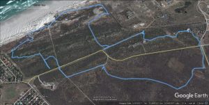
Grysbok Hiking Trail (Alternate Route 1) Advertised as 2.5 k
At 10:41, I started to hike from the Visitor’s Center after looking briefly at the map. I didn’t read the summary of the Grysbok trail so I didn’t see that there are two alternative routes for the Grysbok Trail. I had already formed a picture in my head, before I started, that the trail was around 6 km long and that it would take me around 2 hours to finish.

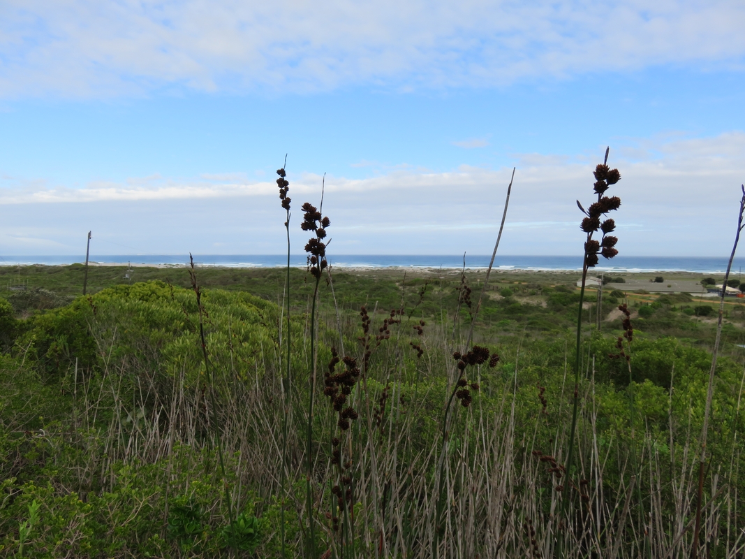
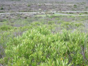
I walked behind the Visitor’s Center where the path widened and consisted of white beach sand. The trail then climbed a very slight hill which affords you beautiful views on either side of the path. On the one side you have a view of the beach and the Atlantic ocean. On the other side you have views of the Reserve and the rich variety of fynbos that it has to offer.
After reaching the top of the small hill, the trail turned off to the right and descended again.
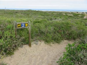
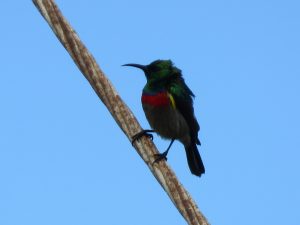
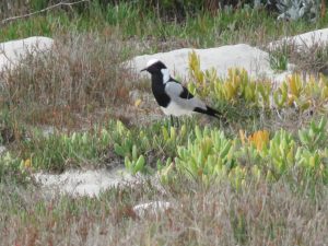
The number 2 signboard is located near to the meteorological station. While walking down the hill, I managed to take a photo of a sunbird that was perched on one of the support cables.

At 10:55, I reached a face brick building on the right of the path and I turned left on to a gray paved section and then on to a jeep track leading off to the left. The trail headed in the direction of Blouberg Hill in the distance.
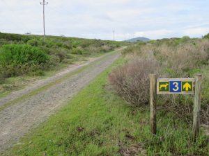
I walked all the way along the gravel jeep track and passed signboard number 3. This is where you can find a salt pan. I must admit I didn’t see any salt pan. Perhaps I wasn’t looking in the right direction.
I did manage to spot a lot of birds on this stretch of the trail. This part of the trail is alive with bird life.
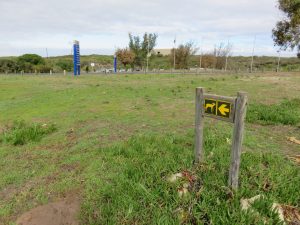
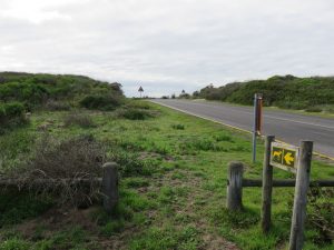
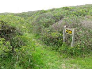
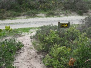
At 11:10, I reached the bend in the tar road. There was a Grysbok signboard there on the left showing that I had to turn left and cross the tar road to the other side where there was another Grysbok signboard.
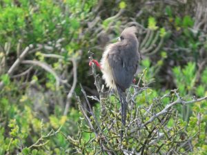
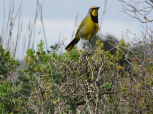
Before I passed the above signboard, I managed to take a photo of a bokmakierie (Telophorus zeylonus) which is a type of bush shrike. It didn’t seem to mind that part of the bush was lifting it’s plumage for all to see. The distance covered to that point was 1.1 km with a moving time of 16 minutes which included a lot of bird watching breaks.
I followed the sandy path to the right and the trail opened into a wide track.
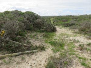
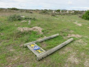
I continued walking along this path and walked passed a no 6 signboard lying on its back. I continued walking on straight passed it because I was looking for the no 4 signboard. I walked until I reached a jeep track with a Grysbok signboard pointing back the way I had come. I turned around and headed back to the no 6 signboard that I had chosen to ignore.

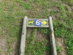
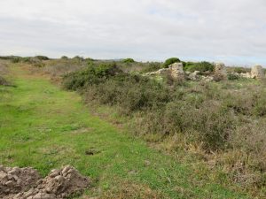
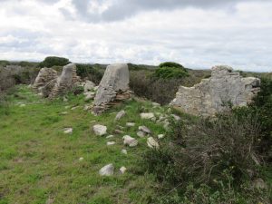
At 11:26, I returned to the no 6 signboard and I turned right there and walked passed the ruins of an old farm house on my right hand side.
I continued along the path and wrestled with a growing feeling inside me that I had taken a wrong turn somewhere and had missed signboards 4 and 5 along the way.
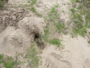
I walked along the path and tried to avoid the many mole hills that dotted the trail. I got a bit too close to one and my right shoe disappeared into the sand and created a small shoe shaped sink hole in the ground. Fortunately I was only walking and not running. If I was running I may had done some damage to my ankle.

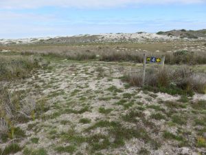
As I walked along the path, I kept a watchful eye out for signboard 7, but did not see it anywhere. The plant and fynbos species in that area were something to behold.
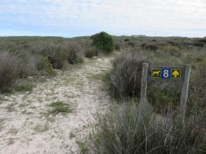
The next signboard that I encountered was no 8. According to the leaflet, this signboard pointed to the wetlands. Again, I didn’t see any wetlands. Perhaps it was due to the current water crisis that the wetlands had disappeared.
That spot, I discovered, was quite close to the end of the trail. The path turned right there and after a short distance it straightened and ran down toward the Visitors Center on the hill.
The trail then crossed the tar road and joined with the paved disabled entrance pathway to the Visitor’s Center.
At 11:53, I reached the Visitor’s Center and the end of the hike. The total hiking distance was 3.4 km with a total moving time of 47 minutes and a total hiking time of 01h12. I then realised, after reading the pamphlet again, that I had walked the shorter of the two Grysbok alternate trails that was advertised as a 2.5 km walk. If you subtract the wrong turns that I took then, realistically, the trail distance would be around 2.5 km.
I was determined to find out where I had gone wrong so I decided there and then to do the hike again from the start.
Grysbok Hiking Trail (Alternate Route 2) Advertised as 5.7 km
At 11:55, I started the hike at the Visitor’s Center making sure that I followed my progress on the map provided.
I walked the route as described above until I reached the face brick building where I made sure that I hadn’t missed any Grysbok Trail signage there. I didn’t find any other signage there. I decided to follow the same route as the shorter alternative and walked passed the no 3 signboard again.
When I approached the tar road again, I looked at the map and it appeared that the trail turned right toward the beach and not left and across the road. At 12:13, I noticed that there was a grassed jeep track headed off to the right with a blue and white sign that indicated that the track went to the beach. The distance covered to that point was 1.2 km with a moving time of 16 minutes.

There were no Grysbok Trail signboards in sight. I went with my gut and turned right there and walked along the jeep track until I found a Grysbok signboard indicating that I should keep walking along the jeep track towards the beach.
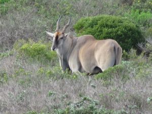
The jeep track then curved to the right and headed straight for the nuclear power station perimeter fence. At 12:22, I reached the perimeter fence where there were signboards stating that it was a restricted area and that I could not proceed any further in that direction. I turned to my right and saw a huge Eland grazing in the bushes.
Again faced with no Grysbok Trail signboard to follow, I decided to turn left and walked along the perimeter fence toward the beach.
After walking a short distance along the fence, I saw 3 footpaths running off to the left and I decided to follow them. I later found Grysbok signboard no 4 facing in the direction of the jeep track. I must have missed the turn off to the left from the jeep track, although I didn’t see any signboard indicating the turn.
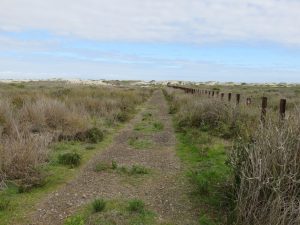
The trail continued along the path I had been walking on and ran parallel to the sand dunes.
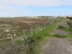
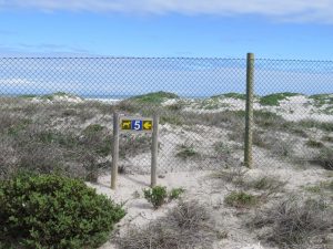
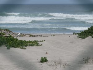
At 12:32, I reached Grysbok signboard no 5, located next to a green perimeter fence. The information pamphlet indicated that it was a viewing point. I took a photo of the beach through the fence.
I continued walking along the sand track with the green perimeter fence on my right.
At 12:36, I came to an intersection with another jeep track. The Grysbok signboard indicated that I should continue straight over the other jeep track and walk alongside the perimeter fence. The distance covered to this point was 2.5 km. The elevation was 4 m.
At 12:40, after a short distance a signboard indicated that I needed to turn left off the jeep track followed by a right turn. The distance covered to that point was 2.8 km.
At 12:44, the trail zigzagged left and right inside the bush with signboards indicating the changes in direction, all the while heading back in the general direction of the Visitors Center.
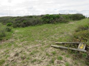
I came across a few signboards that were lying on the ground, but positioned in such a way to indicate the direction of the trail. This one below indicated that I had to turn right which I did. I reached that signboard at 12:50. The distance covered to that point was 3.4 km.
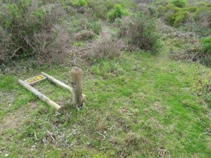
The next signboard I came across indicated that I must continue straight on which I did. However this path took me close the border of the Reserve and was clearly not the right route. I backtracked along the path I had taken and turned right at this signboard and quickly found that it was the correct path. This signboard was misleading and should be addressed.
After a short distance, I encountered another signboard on the ground which indicated that I should take the right fork which I did and which was the correct path. The distance covered to that point was 3.7 km.
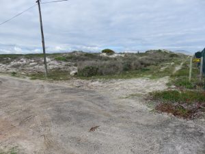
The trail then intersected with the jeep track that I had crossed over earlier at the perimeter fence. I turned right there and walked toward the security hut that controlled access to the other entrance to the Reserve.
The trail takes you behind the security building and straight over the road. I was stopped by security officials there and asked to present my visitors sticker, which I did. I proceeded over the road and on to a gravel jeep track that headed in the direction of the R27.
At 13h01, I reached a Grysbok signboard that indicated that I needed to turn left on to another pathway. I recognised this as the same signboard that I had come to earlier after walking passed Grysbok signboard no 6 and being forced to turn around and head back to the same no 6 board.
The distance covered to that point was 4.0 km with a moving time of 52 minutes. The total time on this second alternate trail was 01h06.
At 13h05, I arrived again at my old friend, the no 6 Grysbok signboard, next to the old farm house ruins. I turned right there and followed the same trail that I walked earlier that morning.
I continued on the path I had walked before and reached the Visitors Center at 13h26. The total hiking distance for the second alternate trail was 5.9 km. If I had to subtract all the wrong turns I took, the trail was closer to being 5.7 km. The hiking stats for this second alternate Grysbok Trail is listed below.
The Stats
There were no distance markers on either of the Grysbok Trails (Alternate 1 & 2).
The alternate Grysbok (shorter) Trail 1 had a total walking distance of 3.4 km.
The alternate Grysbok (longer) Trail 2 had a total walking distance of 5.9 km.
Here are the hiking stats for the Grysbok Trail *Alternate Route 1:
| Trip Odometer | 3.44 km |
| Total Time | 01h13 |
| Moving Time | 47h40 |
| Moving Average | 4.3 km/h |
| Overall Average | 2.8 km/h |
| Max Speed | 8.4 km/h |
| Elevation | 4 m – 31 m |
Here are the hiking stats for the Grysbok Trail *Alternate route 2:
| Trip Odometer | 5.93 km |
| Total Time | 01h31 |
| Moving Time | 01h15 |
| Moving Average | 4.7 km/h |
| Overall Average | 3.9 km/h |
| Max Speed | 8.6 km/h |
| Elevation | 4 m – 31 m |
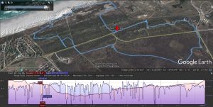
I have attached a GPS trip log for the second (longer) Grysbok alternate route, including a side elevation profile. You can clearly see where I went off route and had to back track to get back on the trail. These are the sections on the trail where the signage needs some improvement.