@Safetymountain Tracking – Your Own Virtual Hiking Support Team
@safetymountain Tracking – Your Own Virtual Hiking Support Team
UPDATED: 23 FEBRUARY 2019
I cannot remember how I first heard about this free service offered by the Hikers Network, South Africa. It could either have been through another hiker on the trail or while listening to Tim Lundy on his weekly hiking slot on CapeTalk with Koketso Sachane. By the way, Tim Lundy also has his own blog that you can read about here.
Here is a list of the topics that will covered in this blog post about the @safetymountain Tracking service:
- How Did This All Come About?
- How Does It All Work?
- How Can You Sign Up?
- What Happens When You Go Hiking?
- What Does It Mean To Be Tracked
- What Needs To Happen On The Hike Itself?
- What Must Happen After You Complete Your Hike?
- Useful Numbers For Mountain Emergencies
- The Benefits To Using The @safetymountain Tracking Service
- Other Benefits To The @safetymountain Tracking Service
- @safetymountain Tracking – A Review
- Crime Hotspots on Table Mountain
1. How Did This All Come About?
Like most successful ventures, it started with a great idea. One of the founding members of the Hikers Network, Mr Anwaaz Bent, decided to track members of the Hikers Network in 2010. It was a way in which he could keep tabs on his hiking club members out on the mountain in case of an emergency on the mountain. It was eventually expanded to include interested members of the public who enjoyed spending a lot of time on the mountain and who wanted some added reassurance. If you want to read more about how this all began, you can read it here.
2. How Does It All Work?
The way the service works is that you register with @safetymountain Tracking which is managed by the Hikers Network. They will then add your mobile phone number to one of the @safetymountain Tracking WhatsApp groups. Once you are on the group, you ‘check in’ at the beginning of your hike and then send regular updates of your progress on the trail until you are back safely off the mountain. While you are hiking on the mountain, one of the volunteer ‘trackers’ on the @safetymountain Tracking group will ‘track’ your progress and assist you in case you run into trouble.


3. How Can You Sign Up?
You need to visit the Hikers Network website and complete the online form. The information they will need from you to put you on one of the @safetymountain Tracking WhatsApp groups is listed as follows:
- Full Name
- Contact Number (Mobile)
- Medication/Chronic illness/Allergies
- Next of kin name and contact number
- Email address
Click on the submit button and wait until you are added to one of the @safetymountain Tracking WhatsApp groups. If you are happy with the service and you want to add another member of your family or a friend, they will each need to fill in the online form. You won’t be able to request that they be added directly on the @safetymountain Tracking WhatsApp group chat.
To view and complete the Hikers Network @safetymountain Tracking online form, click here.
4. What Happens When You Go Hiking?
Just before you set out on the trail, you will need to open the @safetymountain Tracking WhatsApp group and post a message with the following information:
- current time or the time you intend to start your hike
- number of people in your group, abbreviated to ‘pax’
- your start and finish locations
- your intended route
- an alternate mobile number of any other person in your hiking group
- your ETA (estimate time you will complete the hike)
- Your name
An example of a message that you would post is:
Good morning. 6 adult pax hiking up Kloof Corner, along the Contour Path and descending via Platteklip to Tafelberg Rd. Alternate number 084 123 4567 – Gordon. Starting now at 07:00. Eta 09:30. Ken
Once you have done that, one of the volunteer ‘trackers’ will acknowledge your message and keep in touch with you until you are safely off the mountain.
TIP: Please remember to read the message from the volunteer ‘tracker’ as they may have asked you for additional information that you may have left out of your ‘start’ message, by mistake. He or she might also want to warn you that your planned route will go through a crime ‘hotspot’ area.
After you have checked the message from the volunteer ‘tracker’ and you are sure that you have given all the information required from you, you can head off and enjoy the hike.


5. What Does It Mean To Be Tracked?
What is meant by the term ‘track’ is that one of the volunteer ‘trackers’ will monitor the @safetymountain Tracking group that you ‘checked in’ on will keep on eye on your progress to see if your hike is going according to plan. The ‘tracker’ will also respond to any messages sent by you where you request assistance. He or she will get in touch with the relevant authorities to assist you, whether it is a SAN Park Ranger, the Metro Rescue Service or the AMS (Air Mercy Service) rescue helicopter.
‘Track’ does not mean that the location of your mobile phone appears on some type of monitor in a control room. Your ‘tracker’ could be anywhere in the Province or even in their own home in Cape Town. They are trained to assist you in an emergency situation and will contact the emergency services on your behalf, if you get into trouble.
If you do get into difficulty or one of your hiking party is injured or becomes ill, you will then make use of the ‘send my location‘ function on your mobile phone. This is often referred to as ‘dropping a pin‘. Sometimes in emergency situations, you panic and as a result you are not able to accurately describe your current location. The Hikers Network have listed the steps you will need to follow on your phone to be able to send your location to the @safetymountain Tracking group so that your ‘tracker’ knows exactly where you are. Just remember to wait until the accuracy value drops to under 15 m. If you don’t wait, you will send an inaccurate location thus increasing the search area to be covered by those looking for you. This is vital as the ‘tracker’ needs to get the right resources to you without delay. To check out these steps you can click here. They are listed below the online application form.
TIP: The longer an emergency situation takes to be resolved the more the risk increases for the injured person as well as the rest of the hiking party.
6. What Needs To Happen on the Hike Itself?
Because this service is online based, it needs to have regular input from you to be effective. The hiker who has ‘checked in’ on the @safetymountain Tracking group at the start of the hike needs to monitor the group and send regular updates regarding the group’s progress on the trail. The suggestion is to send updates every hour or so or when the group has altered the intended route for some reason. or if someone is injured or falls ill.
You would also need to keep an eye on the @safetymountain Tracking group to see if any other hiking groups are in need of assistance as you may be the closest resource to them.
TIP: Just remember that once you have sent your location to the @safetymountain Tracking WhatsApp group in an emergency, you should not move from that location. Try to first identify a location that is sheltered from the elements where you and the injured person can wait for the rescue party to arrive. Once you are satisfied that you have found some type of shelter within a few meters and in sight of the trail, then you can send your location. You might have to wait for a couple of hours before help arrives. Table Mountain is approximately 221 km2. So keeping warm and dry and out of the wind becomes essential.
If you are faced with an emergency situation on the mountain and it runs into the evening hours, it is important that you do not continue to try and get off the mountain on your own. The mountain is very different in the dark and one wrong decision on your route choice can have serious consequences. Send your location to the @safetymountain Tracking WhatsApp group and wait for further guidance on what to do.
7. What Must Happen After you Complete your Hike?
Once you have reached your end point, and not before, you need to send a message on the group confirming that you have finished and that you have all the hikers with you that you started the hike with. The message is basically confirming that you are safely off the mountain or SOM for short. Please also thank your volunteer ‘tracker’ for looking after you as this is a voluntary service and each one of them is giving up their free time to help others, without getting paid for it. The abbreviation used on the group is T4T (thanks for tracking).
An example of such a message would be: We are all SOM. T4T.

8. Useful Numbers for Mountain Emergencies
These are listed in order of importance. For more serious incidents dial the first number. For the less serious incidents contact SAN Parks. Put these numbers in your phone now. You won’t remember to do it later on. Include the words “Table Mountain” when you save these numbers as contacts so that they will all come up, on a contact search, if you have an emergency. You will not remember the individual names of these services when you are anxious or stressed.
- City of Cape Town Emergency Control Centre (021) 480 7700
- Metro Rescue (021) 937 0300
- SAN Parks (Technical Operations Centre) (021) 957 4700 & 086 110 6417
TIP: When calling one of these numbers, remember to tell the person you are phoning about a mountain emergency so that they can put you in touch with the right emergency service.
9. The Benefits to Using the @safetymountain Tracking Service
When I am out hiking on a mountain, or even when I am not hiking, I am provided with useful information by the @safetymountain Tracking group, about:
- Adverse weather conditions on the mountain
- The latest crime related ‘hotspot’ areas
- Fires that have started on the mountain
- Emergency numbers is case of an incident
10. Other Benefits to the @safetymountain Tracking Service
There are also other benefits to using the @safetymountain Tracking service that one would not necessarily think about until you start using the service.
Proper Pre-Hike Preparations
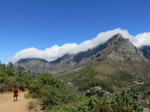
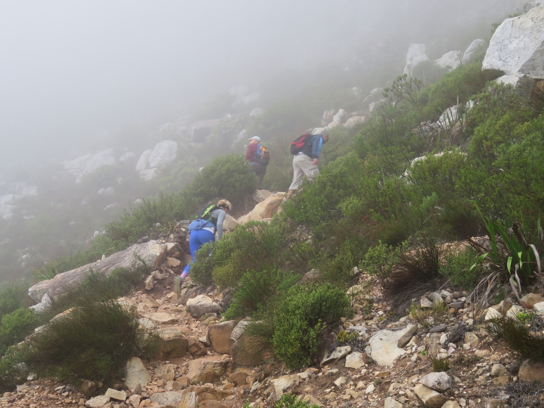
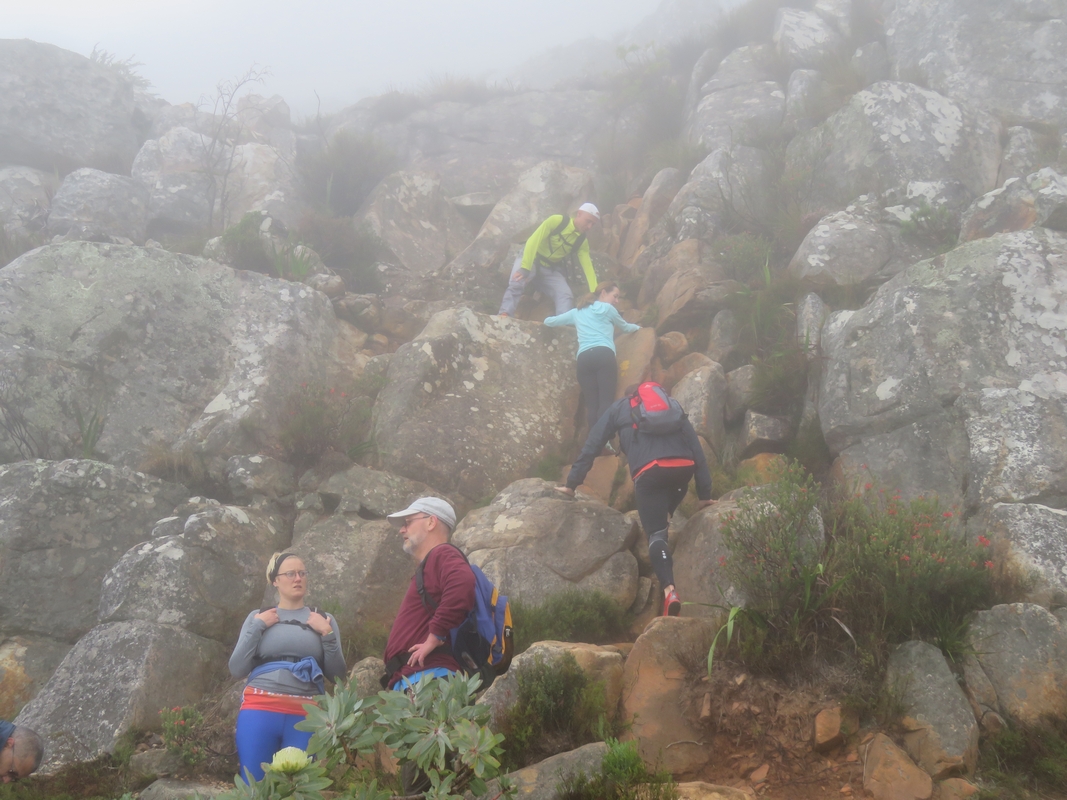
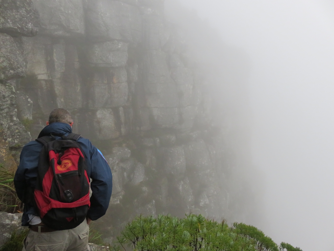
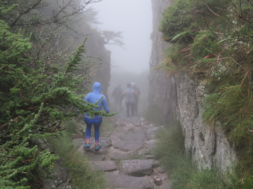
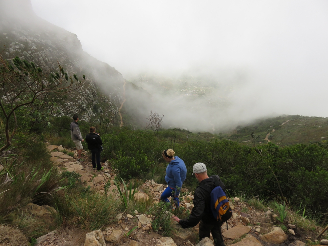
The @safetymountain Tracking service compels you as the hike leader, or simply as someone who is part of the hiking group, to plan your route beforehand and to calculate how long it is likely to take you to complete the hike. The weather is also a factor that will need to be taken into account with any planned hike on Table Mountain. The weather on the mountain is often unpredictable and you may find yourself shrouded in mist within minutes. Thick mist can cause you to become disorientated which is dangerous on a mountain with sheer cliffs. Being part of a @safetymountain Tracking group will teach you to be cautious when planning a hike. You will become all to aware that Table Mountain, or any mountain for that matter, can turn from being a natural wonder to being a natural disaster.
Doing A Pre-Start Head Count
Ask yourself this question. How often have you started a hike with friends or with a group you have just linked up with on the day without checking to see how many people are in your hiking party? I know I have. It follows that if you don’t know how many people started with you, it will be very difficult to notice if one of your party wanders off or falls behind, especially if the mountain is shrouded in thick mist. When you ‘check in’ on the @safetymountain Tracking group, you are required to give the total number of people in your hiking group, before you start hiking.
Hiking Situational Awareness
Often when I have gone hiking, I have tended to spend lots of time enjoying the view and walking more slowly through sections that I find interesting to look at. While there is nothing wrong with taking time to enjoy the view, you also need to maintain situational awareness and be aware of how much daylight you have left to complete the return journey. The @safetymountain Tracking group encourages you to report your progress regularly and through this you will remain aware of your intended eta and whether you are still on track, time wise. Your ‘tracker’ can also advise you if he or she can see that you will not going to complete your hike before it gets dark.
Additional Resources on the Mountain if Needed
Another benefit to the @safetymountain Tracking group is that if another hiking group were to run into trouble, the @safetymountain Tracking group will be able to notify your group, if you are closest, significantly reducing the response time to the group in trouble. There is however no obligation on you to go to the aid of the other hiking group if you feel that your group is not up to the task. Also this does not apply to muggings as the @safetymountain Tracking group message would not be to converge on a mugging incident, but rather to alert you to change course immediately to avoid that area.
Reporting Suspicious Persons on the Mountain
By joining the @safetymountain Tracking group you become an extension of the SAN Parks Rangers in that you become their eyes and ears on the mountain. The @safetymountain Tracking group does not encourage you to confront suspicious persons, but rather to report their presence on the mountain and the area they are in so that the Rangers can investigate. The idea is to prevent a mugging rather than having to respond to a mugging after it has already happened.
Reporting Fallen Trees, Blocked Paths
By using the ‘send my location’ function on your mobile phone you will be able to alert the Rangers, via your @safetymountain Tracking volunteer ‘tracker’, to a specific location where a tree has fallen across the path or where a boulder is blocking the path from a recent rock slide. You will be doing your fellow hikers a favour by reducing the time it will take to remove the obstruction from the trail. Again remember to make sure that the accuracy value drops to below 15 m before sending your location message. Also it needs to be a significantly sized tree or boulder that blocks the path which may cause an injury to a hiker trying to climb over it, or go off path to get around it.
11. @safetymountain Tracking – A Review
I have used the @safetymountain Tracking service around 30 times since the beginning of 2018. On 18 of these occasions, I was hiking on Table Mountain and the surrounding mountains while 12 of these ‘tracks’ were for mountains outside of Cape Town, including Stellenbosch, Du Toit’s Kloof, Montagu, Robertson and the Cederberg,
Each time that I have ‘checked in’ via the @safetymountain Tracking WhatsApp group, a volunteer ‘tracker’ responded quickly and was able to monitor our hiking group’s progress along the trail until we were safely off the mountain.
By regularly using the @safetymountain Tracking group, I have learned where the traditional crime hot spots are and I have avoided them, where possible. I have even cancelled planned hikes in areas where muggings were currently occurring.
Another important bit of knowledge that I have accumulated while using this service, is about which hiking trails have little to no cellular telephone service. When you are involved in an emergency and you discover, only at that stage, that there is no cell phone signal where you are, it might be too late. Do you go back or do you continue on to find reception? It is better to know where these cell phone ‘dead spots’ are on a trail beforehand so that if you do get in to trouble in one of these ‘dead spots’, you know where you need to get to, to get reception and call for help. By using the @safetymountain Tracking service you will be checking your phone regularly for messages and signal strength.
I can highly recommend this free service as it gives one a sense of security when hiking on the mountain because you know that there is someone keeping track of your progress and ready to help if you get into trouble. It also helps you to better prepare yourself for your hike and to take better care of your hiking group while hiking, even if you are not leading the hike.
Ask yourself, why would you not want to use this free service?
12. Crime Hotspots on Table Mountain
During the week leading up to your hike on Table Mountain, it is a good idea to visit the Table Mountain Watch Facebook page where you can get up to date information on the latest crime hotspots on the mountain. The Facebook page is Table Mountain Watch and their Twitter handle is @TableMntnWatch
1 thought on “@Safetymountain Tracking – Your Own Virtual Hiking Support Team”