The Bush Pig Trail – A Crackling Good Hike
The Bush Pig Trail – A Crackling Good Hike

After living in Cape Town for pretty much all of my adult life, Belinda and I made the decision to move to the Garden Route. There were personal reasons for the move, but it was also a good move work wise. As a member of the SAPSTAP Hiking Club, I set about identifying short hikes that the club could host on Wednesday afternoons. This meant driving around and talking to fellow hikers to get ideas on where to look for good ‘short hike’ options in the Southern Cape. There were slim pickings at the beginning as each person I spoke to only knew of one or two hikes, but when I put all the suggestions together, a rather decent looking list started to take shape.
The first hike that SAPSTAP hosted was the Buffalo Bay Hiking Trail situated just outside the coastal village of Buffalo Bay. It was the perfect introductory hike and 9 hikers attend the inaugural Wednesday hike of 2019. Better late than never. You can read all about it here.
For the second hike, I needed a hike with a twist. It should be fairly easy, but it should also showcase what the Garden Route has to offer in terms of natural beauty. The Bush Pig Trail promised, at the outset, to tick all of those boxes. While it was a thoroughly enjoyable hike, a large part of the trail was closed for maintenance. We made it work, by incorporating a part of the Galjoen Trail which meant that we got to hike a 2.7 km stretch along the beach which was brilliant!
How to get there
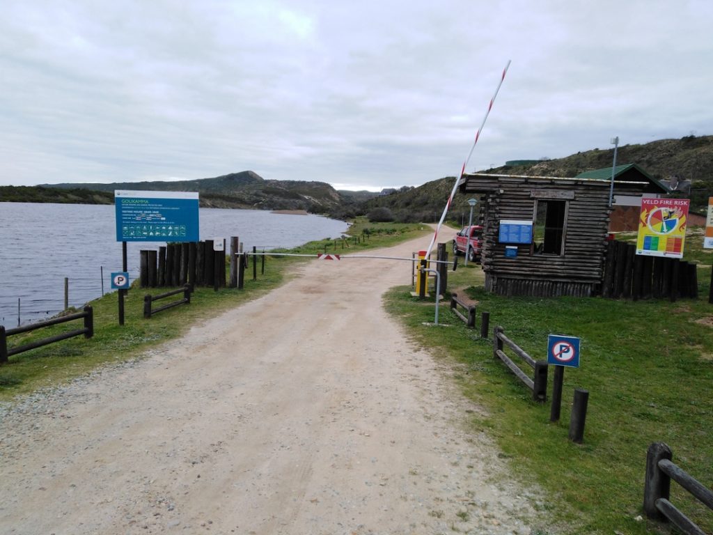
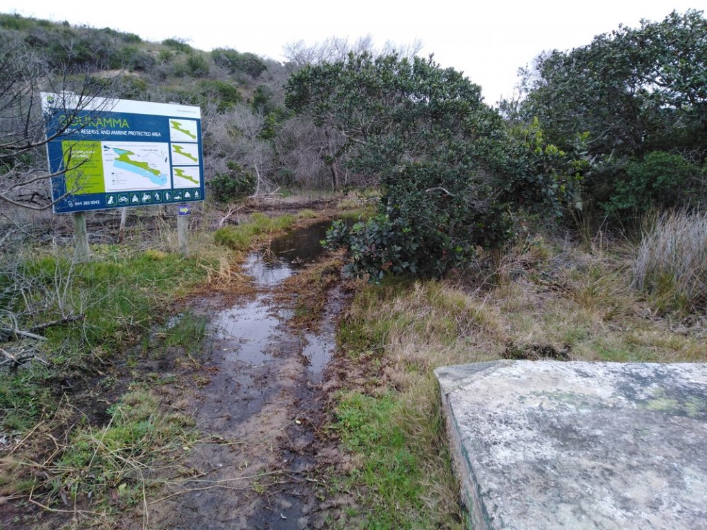
The Bush Pig Hiking Trail is located in the Goukamma Nature Reserve and Marine Protected Area. The reserve is situated on the main road into Buffalo Bay that runs off the N2 Highway between Sedgefield and Knysna. The turnoff into the Goukamma Reserve is approximately 5.8 km from the N2. lf you reach an open parking lot on your right, then you have gone too far. There is a wooden hut with a boom gate at the entrance to the reserve where you sign in and get your permits. You are also given a copy of the Goukamma Hiking Trails Map and brochure which you can read here.
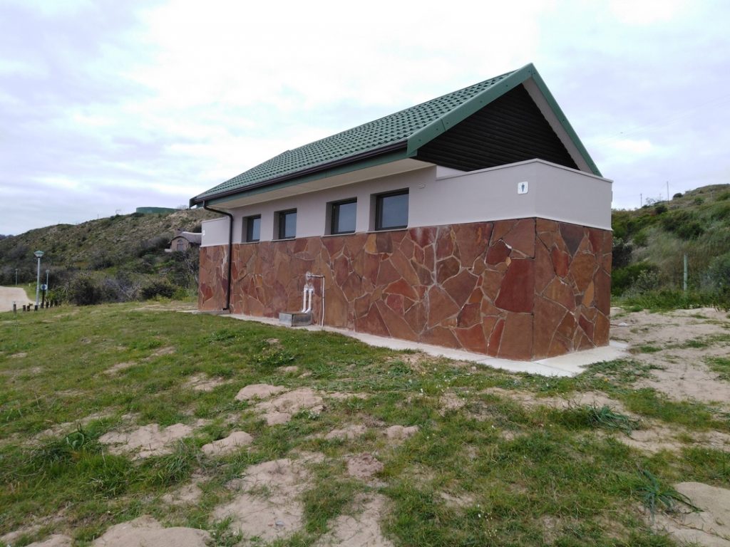
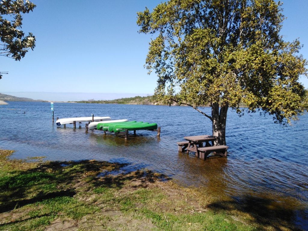
Once you have signed in and you are in possession of your permit, you need to drive on for another 500 m to the picnic area where you can park your vehicle facing on to another ablution facility. You can’t miss it as that is where the bright yellow paddle boats are stored next to the water’s edge. The tide was really high and a large part of the picnic site was underwater. I can imagine that on a hot summer’s day picnicking with your feet in the water will be just what you need to keep cool.

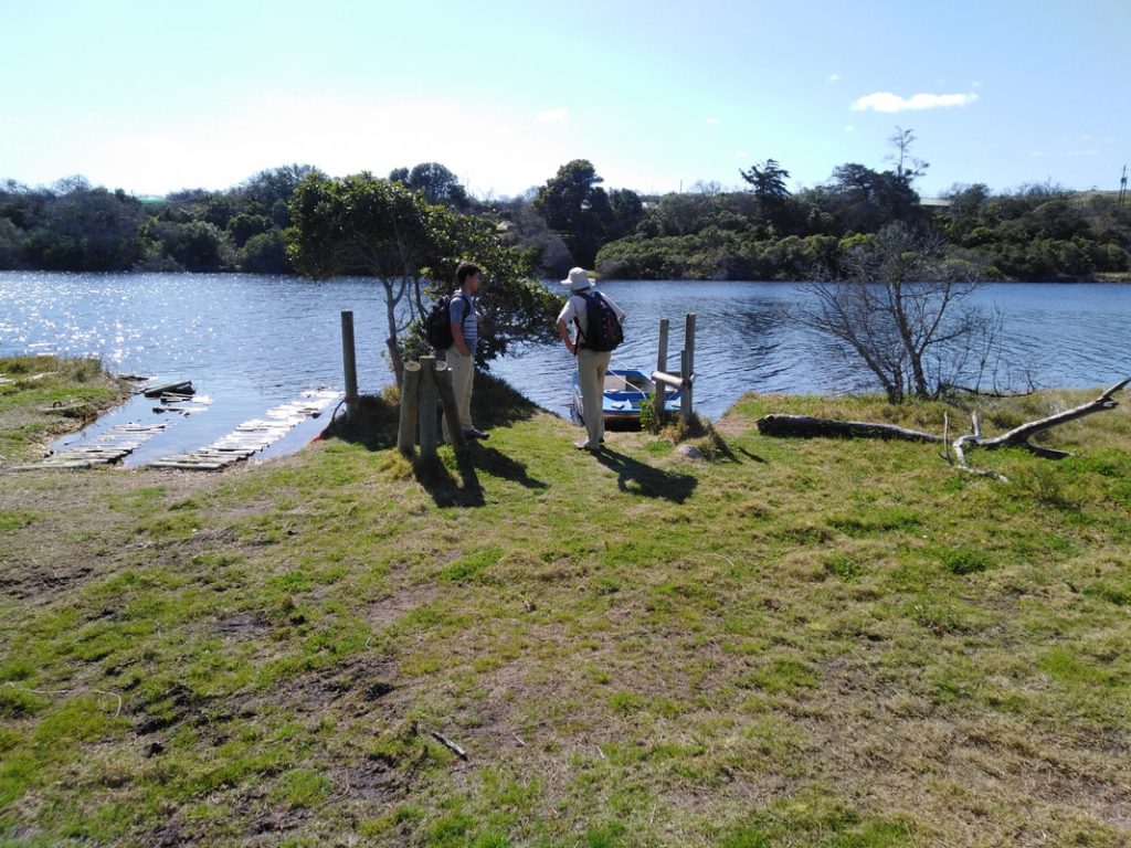
Follow the jeep track, in the direction of the office, for another 190 m to the Ferry Head where the blue and white boat is waiting to take you across the Goukamma River to the start of the trail.
Caution: Water Safety
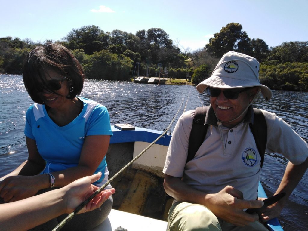
There is a sign in the little ferry (dinghy) that states that life jackets are compulsory, although this was not explained to us by the Cape Nature official. We didn’t have any life jackets. It is not a very stable watercraft. If someone was to stand up in it, mid crossing, (not advised) the boat would probably capsize and those who cannot swim would almost certainly drown. All four of us could swim, but if you are hiking with children or with someone who cannot swim, I would strongly advise that you get a life jacket from the Cape Nature official at the entrance hut before embarking on the trail. Do not be afraid to ask your entire hiking party who can and who cannot swim. I also would make sure that no more than 4 persons at a time use the boat and everyone must remain seated until the crossing has been completed.
Subsequent to hiking this trail, we made contact with the Management of the Goukamma Nature Reserve and Marine Protected Area. We raised our concerns about the lack of availability of the life jackets at the ferry crossing. We received an email back to say that our suggestion of having life jackets available at the Ferry Head for hikers was valid and they would address it. We are both thrilled to be able to say that as of 30 October 2019, there are life jackets hanging up at the Ferry Head for the use of hikers wishing to cross over using the blue and white dinghy. We encourage all hiking groups with small children and those who cannot swim to make use of these life jackets when making the ferry crossing.
Opening Times
The opening times of the Goukamma Nature Reserve and Marine Protected Area are:
All year round: 08h00 – 18h00
Permit and Watercraft Fees
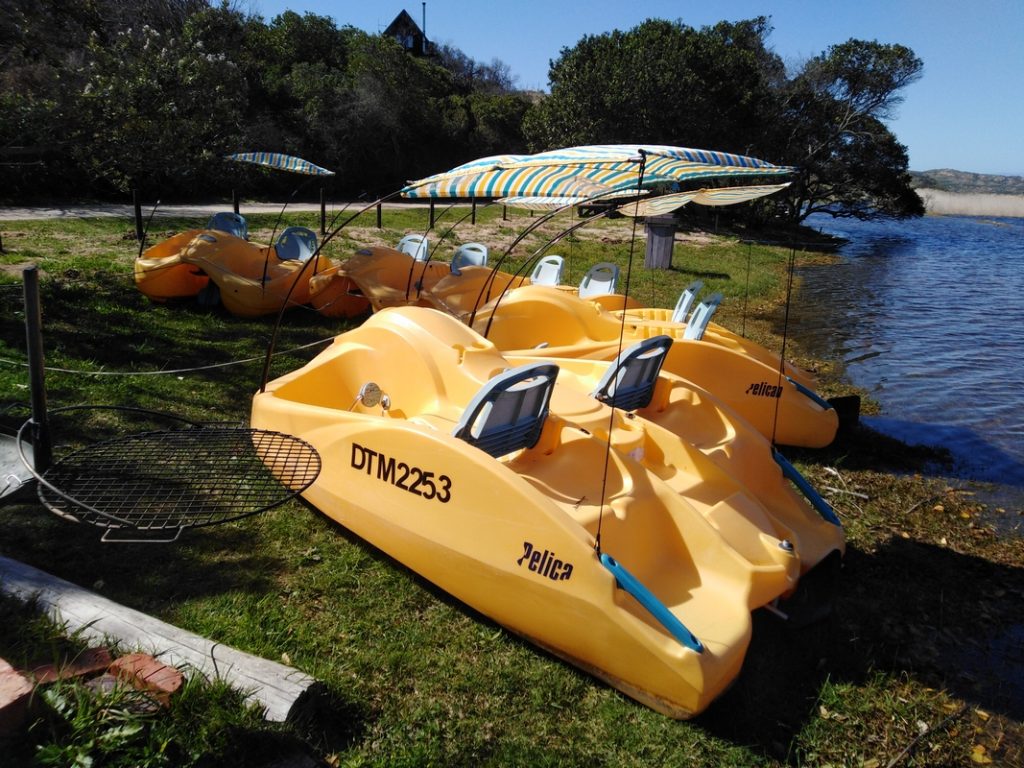
The conservancy fees and the charges associated with the use of the various non-motorised watercraft in the reserve (as of September 2019) are as follows:
| Adults | : R50.00 |
| Children | : R30.00 (4 – 17 years) |
| Toddlers | : Free (3 years and under) |
| Canoe Hire | : R100.00 (Single) R150.00 (Double) |
| Paddle Boat Hire | : R50.00 |
All Wildcard holders are exempt from payment of a conservancy fee, but will still need to get a permit from the Cape Nature official on duty at the entrance to the Reserve.
Contact Information
- General Enquiries: (044) 383 0042
- Emergency Contact Numbers:
- 087 087 3945/6 (Office Hours: 07h30 – 16h00)
- 079 047 2904 / 082 494 1880 (After Hours)
Email address: [email protected]
The Speedy Review
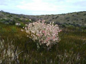
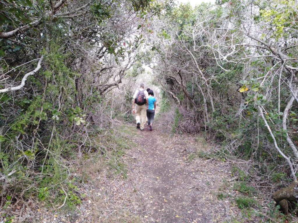
This is a family and child (12 years and older) friendly trail that ordinarily takes you on a loop through a Milkwood forest and along a coastal ridge with stunning views of the beach below. In July and August, you stand a good chance of spotting a few southern right whales in the bay or a few dolphins. Currently, the Milkwood forest section of the Bush Pig Trail is closed for maintenance so hikers can either choose to come back the same way or take the option of returning along the Galjoen Trail which is a 2.7 km stretch along the beach.
Trail Ninometer


Nina rated this trail 0/5 paw prints because dogs are not allowed in the Goukamma Nature Reserve and Marine Protected Area. Nina was at home dreaming of her next nature walk in the Southern Cape.
The Nitty Gritty
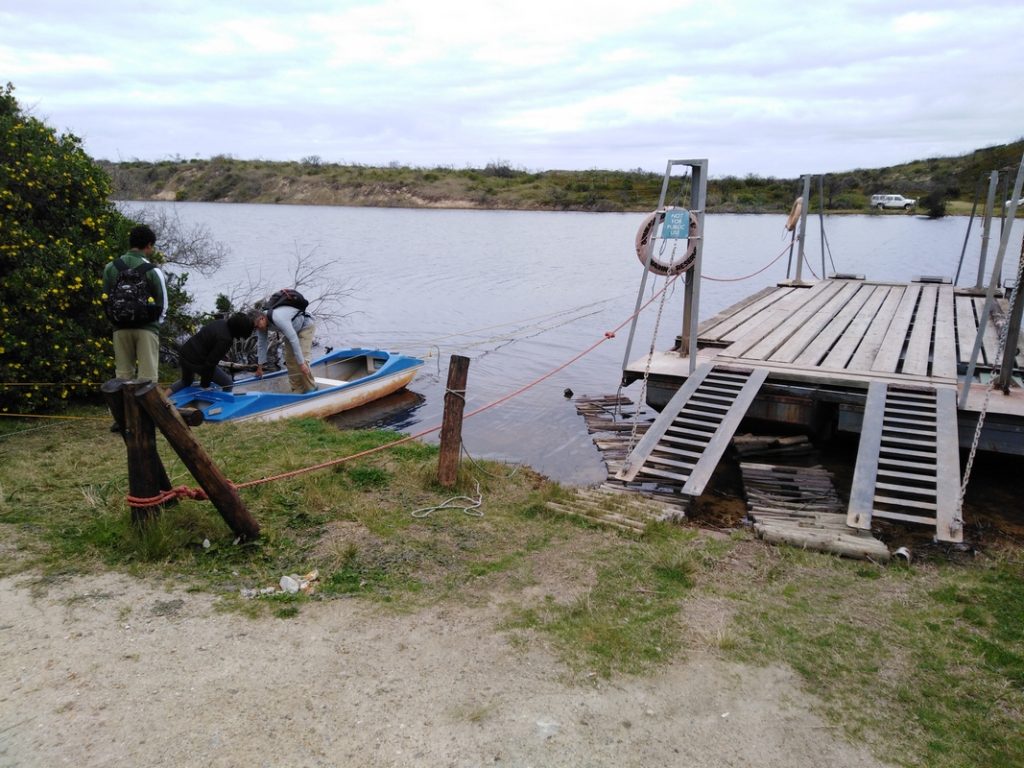

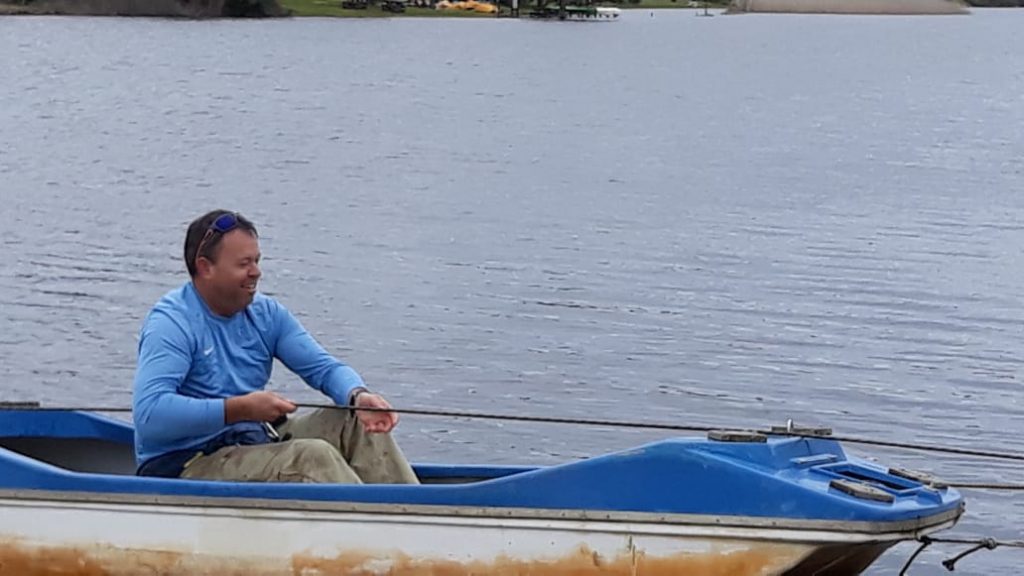
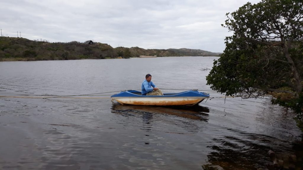
We got to check out this hiking trail on 01 September 2019. After parking our vehicles at the picnic area, the four of us walked the 190 m along a jeep track, to the Ferry Head. To call it a ferry is a bit of a stretch of the imagination, but it looked like a lot of fun! I stayed behind while the three others pulled their way across the river while I took a video. There are three lines attached to the boat. Two yellow lines that are attached to the watercraft and a third black and white line that you pull on to get yourself across. There were no incidents and they arrived safely on the other side. The crossing is approximately 110 m and takes about 2 minutes depending on how many people are in the boat and how quickly they pull themselves across. I would say that no more than four people should be in the boat for each crossing as that would increase the risk of the boat capsizing. You can watch the video of the crossing here.
After they made it across, I started pulling the yellow line to bring the watercraft back to my side of the river. I climbed in and pulled myself across and was quite wet when I reached the other side. As you pull on the rope, the line in front of you rises from the water and goes through your hands. Thankfully I was wearing quick-dry pants from Cape Union Mart which dried quickly after I started hiking on the other side. Let me just say that I felt quite safe during the entire crossing and thoroughly enjoyed it!
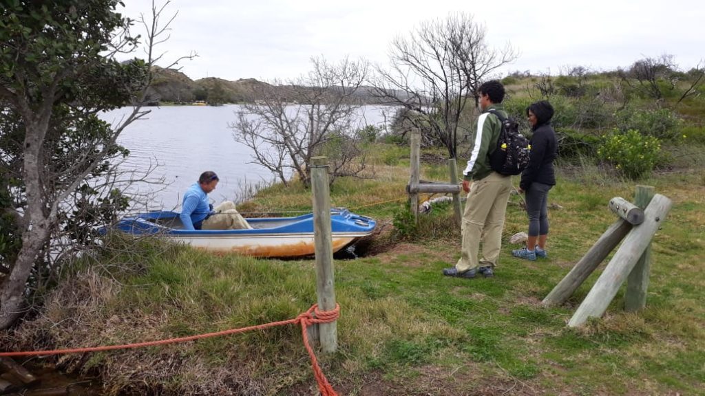
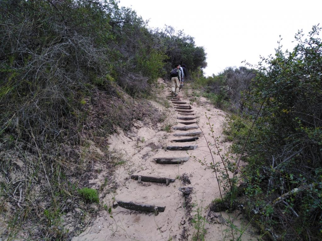
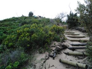
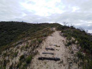
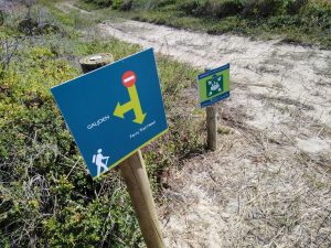
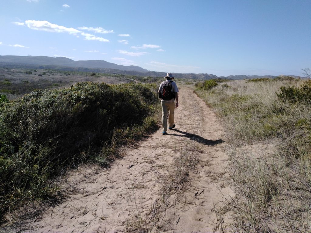
After climbing out the ferry, we regrouped and saw that there was a Cape Nature board off to the right with a small arrow below it pointing to the right. The total distance covered to that point was 300 m, including the 110 m river crossing. I had read a few reviews of the hike so I knew that the Bush Pig Trail went off to the right immediately after you ‘disembark’ from the ferry. The signage could be better though. The trail was completely waterlogged, so we had to find our way around to the right and then cross over to the left again to get back on to the trail. We then started to climb up a wooden pole staircase on the hillside on the left. Once you get up to the top of the first section of the trail, you can look back at the ferry crossing and the Goukamma River below you. We were walking on soft beach sand at that point.
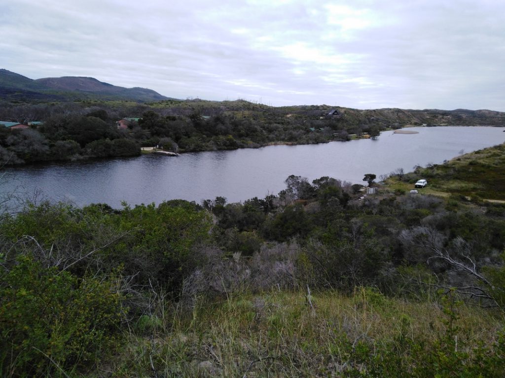
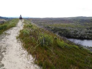
The trail then curved to the left and took us up another hill before turning toward the right, away from the sea and toward the river along a ridge, for a short distance. The ridge gives you a bird’s eye view of the Goukamma River below.
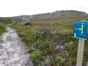
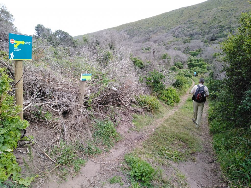
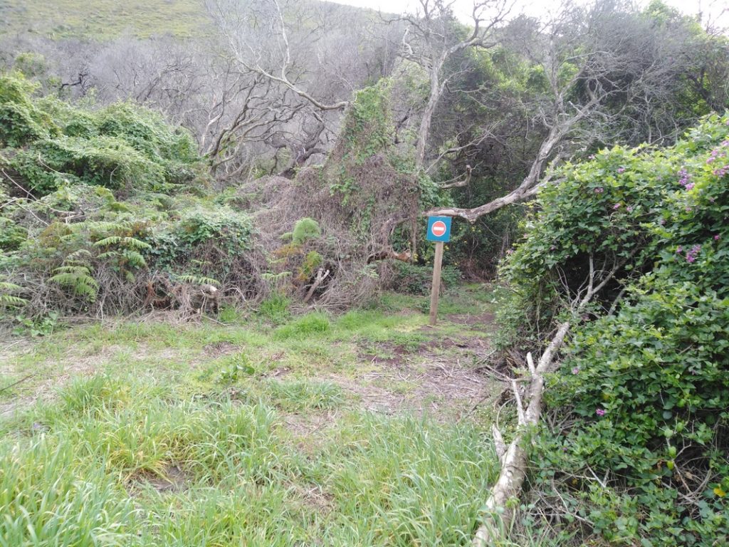
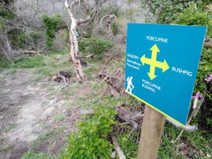
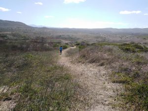
At the end of the ridge, the trail then turned left and descended into a shallow valley. At about 08h45, we reached the point where the Bush Pig Trail split into two options. The distance covered to that point was 1 km. The option to the right takes you closer to the river and then through a Milkwood forest while the option on the left takes you through a coastal thicket. Both options meet up again on the other side, after covering a distance of 3.9 km, where you are able to return to this spot via the route you didn’t opt for. However, when we reached that point in the trail, the option to the right (River/Milkwood Forest) was closed for maintenance and a no entry sign had been erected. Our only option was to take the left fork and hike through the coastal thicket.
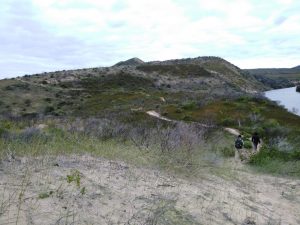
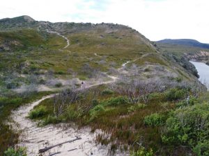
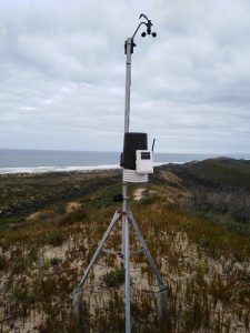
At about 08h55, we started to ascend quite steeply and I could see that we were headed to what looked like the highest point of the trail (1.6 km). There was a metallic contraption placed right at the top which turned out to be a small weather station. At about 09h03 and after a distance of 1.89 km, there was a narrow path that went off the main path to the right. That path took us to the top of the koppie (small hill). We found a trig beacon lying on its side not too far from the weather station. The elevation at that point was a very respectable 110 m (1.93 km).
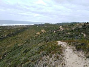
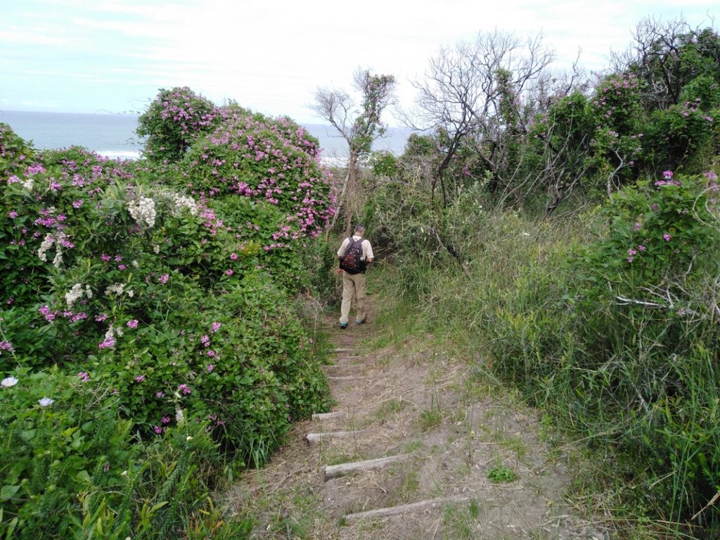
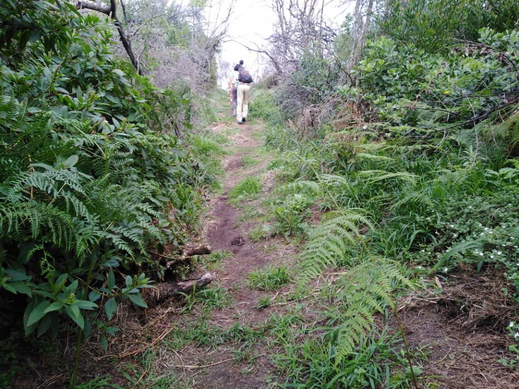
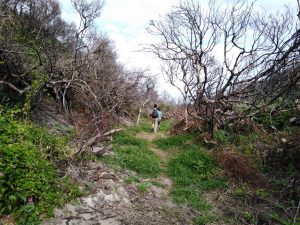
After a brief stop at the top to admire the view, we headed back to the main trail and followed the contour path as it weaved in and out of patches of the coastal thicket. The vegetation had a forest feel to it. Just be aware that there is very little cover on this trail and I can imagine that it would be a very different hike if it is a blazing hot summer’s day.
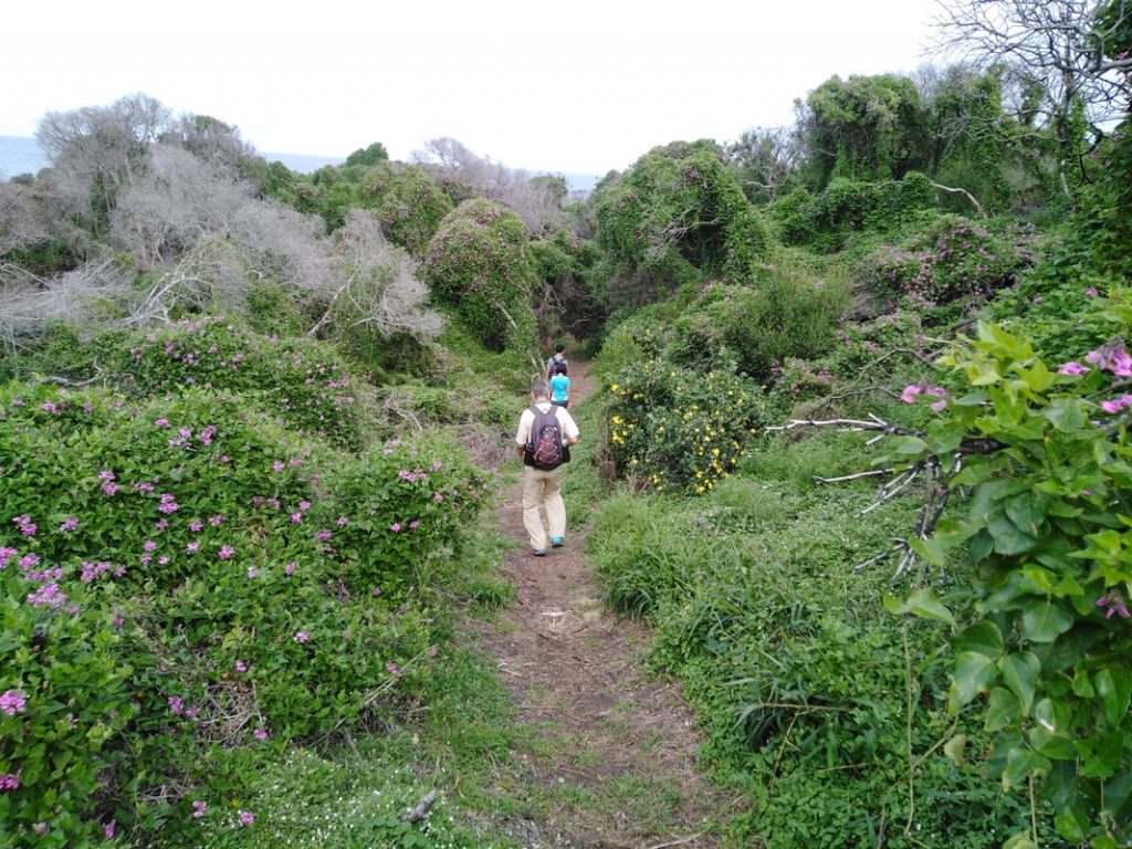
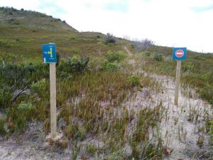
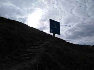
At about 09h38, the path intersected with a jeep track (3.86 km). The signboard showed us to go right. It also alerted us to an emergency pick up point that was 170 m to the left. I wasn’t aware that this trail had an emergency pick up point, but was glad to know that it did, in case anything serious happened. We turned right and followed the jeep track away from the beach. Less than 5 minutes later, we reached the point where the two Bush Pig Trail options came together again. Again, we found a no entry sign erected on the Milkwood Forest/River option which meant that we could not return that way.
However, we now had another option. Instead of walking back along the trail we had just been on, we could turn left and follow the trail to the beach and join the Galjoen Trail. Once on the beach, we could turn left and follow the beach until we saw a trail sign taking us back up the dunes, toward the Ferry Head. Although the hike to that point was enjoyable, none of us wanted to simply retrace our steps when we had the option of returning via the beach. So without much of a discussion, we turned left and headed for the Skimmelkranz Beach. The vegetation along that section showed severe signs of the after-effects of The Great Knysna Fire of 2016. The Great Fire ran through the coastal town of Knysna with devastating and deadly consequences.
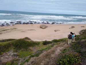
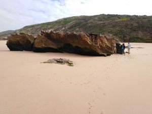
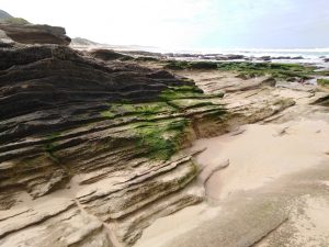
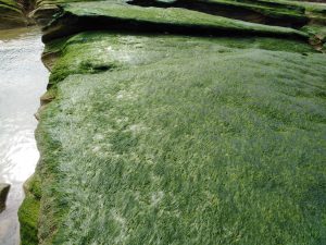
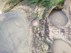
After about a 5 minute walk, we were on the beach (09h50) after walking a total distance of 4.3 km. We all headed for a large rock in the middle of the beach and sat down for a quick snack break. The Skimmelkranz picnic area wasn’t in sight and we guessed, based on a quick look at the map, that it was further up the beach to our right. After enjoying a sandwich and some biltong (dried meat snack) offered by Roderick, I explored the beach area and was lucky enough to spot one of my favourite sea birds, a Black Oystercatcher, with its mate. Roderick also pointed out a few very round rock pools on the beach. It just seemed so unusual for there to be so many perfectly round rock pools. It looked as though the sea’s wave action had decided to drill several perfectly round rock pools for fun. Some of the rocks were covered in a thick layer, of what looked like artificial grass. There was also a healthy supply of blue bottles dotted around on the sand.
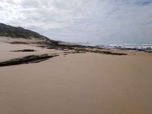


After a 20 minute break (10h10), we headed off again and chose to stick close to the sea and make our way along the shore. The tide was quite high, but there was enough room on the beach to be able to stay on the shore without having to go inland.
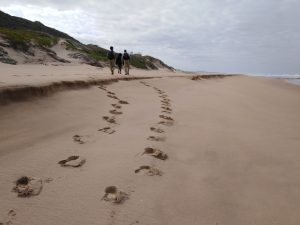
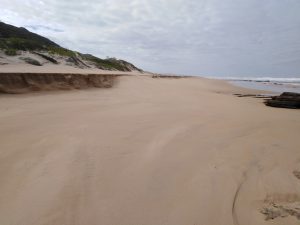


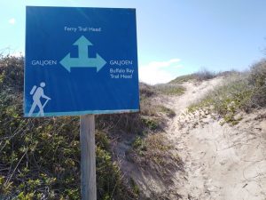
We walked along the beach for about 2.7 km, before we saw the Galjoen Trail sign on a sand dune to our left. We turned off the beach and stopped briefly at the trail sign (10h50) to get our bearings (7 km). After heading over the sand dune, we reached a jeep track (10h57)and a signboard that pointed us to the right. That was also the location of the emergency pick up point that was indicated earlier on in the hike. It is marked as ‘E11’ with contact number (044) 383 0042.
We turned right there and followed the jeep track back toward the Ferry Head, avoiding waterlogged sections as we went. At 11h07, we arrived back at the ferry and decided that all four of us were going to do the crossing together. We made it safely to the other side and ‘disembarked’.
All that was left for us to do was to walk the last 190 m back to our vehicles and we were done!
The Stats – Bush Pig Trail
The total hiking stats for this relatively short day hike, according to my Garmin GPSMap64S device, were as follows:
| Total Distance | 8.33 km |
| Total Time Taken | 03h00 |
| Max Speed | 6.3 km/h |
| Moving Average | 3.9 km/h |
| Overall Average | 2.8 km/h |
| Moving Time | 02h08m |
| Stopped Time | 00h52m |
| Temperature | 8°C / 21°C |